1 Introduction
1.1 Project Background
1.2 Need of the Project
1.3 Objectives of the EIA Study
2 Project Description
2.1 Existing Environment
2.2 Consideration of Alternatives
2.3 Project Design
2.4 Construction Programme
2.5 Maintenance Dredging
3 Summary of Environmental Impacts
3.1 Introduction
3.2 Air Quality
3.3 Noise
3.4 Water Quality
3.5 Terrestrial Ecology
3.6 Fisheries
3.7 Waste Management
3.8 Land Contamination
3.9 Cultural Heritage Impact
3.10 Landscape and Visual Impact
3.11 EM&A Requirement
3.12 Overall Conclusion
1
Introduction
1.1
Project
Background
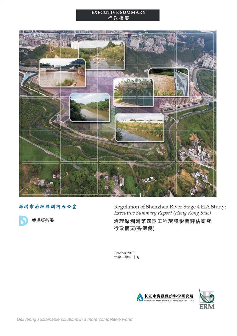
Shenzhen River is the boundary river between the Hong Kong
Special Administration Region (HKSAR) and the Shenzhen Special Economic
Zone. In order to prevent serious
flooding in the vicinity and improve the livelihood of residents on both sides,
the government of the HKSAR and the Shenzhen Municipal Government have jointly
completed the Shenzhen River Regulation Program Stages 1, 2 & 3 between
1997 and 2006. About 13.67 km in
length of Shenzhen River, starting from the confluence with Ping Yuen
River to the river mouth,
has been regulated under the first three stages of regulation program.
The
purpose of the Stage 4 regulation program is to upgrade the flood protection
standard of the Shenzhen
River. In addition, the regulation program will
also tie in with the development of the proposed Liantang
/ Heung Yuen Wai (LT/HYW) Boundary Control Point
(BCP). The proposed Stage 4 of the
regulation program will continue the works of Stage 3 regulation program
starting from the Ping Yuen River to about 1.4 km upstream of the proposed
LT/HYW BCP (a total of about 4.5 km of Shenzhen River will be regulated)
(hereafter “the Project”). In
addition, associated with the river training works, the existing boundary
patrol road and boundary fence of about 4.5 km in length running alongside the
concerned river section are required to be realigned. The location and alignment of the
Project site is shown on Figure 1.1.
Changjiang
Water Resources Protection Institute (CWRPI 長江水資源保護科學研究所) in association
with ERM-Hong Kong Ltd was jointly commissioned by the Shenzhen River
Regulation Office of the Shenzhen Municipal Government (深圳市治理深圳河辦公室) and the Drainage Services Department of the HKSAR to undertake the
Regulation of Shenzhen River Stage 4 EIA Study (the Assignment). This Executive Summary summarizes the
key findings of the EIA related to the requirements of the Hong
Kong side.
1.2
Need
of the Project
The catchment
of the Shenzhen River comprises a “fan-shaped” system,
characterised by short and steep upstream rivers. Large flow from these rivers can
converge into Shenzhen
River within a short
time. During heavy rain storm, the
flood peak can reach the downstream section of Shenzhen River
within a few hours. The flooding
risk of the Shenzhen River is particularly prominent at times of heavy
rain associated with typhoon, where the high sea level suppressed the water
discharge from Shenzhen
River. Prior to the regulation of Shenzhen River, frequent flooding occurred along
the river. Since the completion of
the Stage 3 regulation works, the flood prevention ability of Shenzhen River
is enhanced and the flooding frequency is reduced.
The
section of the Shenzhen
River to be regulated
under this Project is relatively flat, narrow and winding. The width of the river is uneven and
erosion can be found along the river bed and river banks. Some sections of the river embankment
have collapsed. The current flood prevention
performance are in the range of 1 in 2 to 1 in 20 years, which cannot meet the
standard in the PRC National Standard (1 in 20 to 50 years) or the Hong Kong
Standard (1 in 50 years).
Figure 1.2 shows the predicted flood extent of
a 1 in 50 years flood event. As
shown in Figure 1.2,
the extent of the flood will encroach into the villages along Shenzhen River,
including Ta Kwu Ling Village, Kaw
Liu Village,
Chuk
Yuen Village,
Tsung Yuen Ha Village, as well as the boundary patrol
road and part of the Lin Ma Hang
Road.
Hence, there is a need to carry out the Project to rectify the flood
prevention performance of this section of the Shenzhen River
and to safeguard the livelihood of settlements and boundary security along the
river. In addition, the Project
will be required to meet the required flood protection standard for the
proposed LT/HYW BCP development.
1.3
Objectives of the
EIA Study
The Project is classified as a Designated Project
under Item I.1, Part 1, Schedule 2 of the EIA Ordinance and therefore the
construction and operation of the Project will require an Environmental
Permit.
The overall objectives of the EIA Study are to
provide information on the nature and extent of environmental impacts arising
from the Project; to recommend appropriate mitigation measures to control the
potential environmental impacts so that it complies with the requirements of
the Technical Memorandum on Environmental
Impact Assessment Process (EIAO-TM); and to confirm the environmental
acceptability of the Project. Key
environmental issues identified in the EIA Study Brief include air quality,
noise, water quality, ecology, fisheries, waste management, land contamination,
cultural heritage and landscape and visual impacts.
The EIA was conducted in accordance with the
guideline on assessment methodologies provided in the EIAO-TM. The general approach for the assessment
includes description of baseline environmental conditions for the impact
assessment, identification and evaluation of potential impacts and
recommendation of mitigation measures and an environmental monitoring
programme. The assessments in this
EIA Study are conducted using well-proven and internationally accepted methods
based on reasonable worst-case conditions.
2
Project Description
2.1
Existing
Environment
Shenzhen
River is the drainage outlets of
various watercourses in Shenzhen and Hong Kong.
The main tributaries on Shenzhen side include Wu Tong Shan Stream (梧桐山溝), Jing Du Stream (徑肚溝), Chang Ling Stream (長嶺溝) and He Jiao Long Stream (禾叫壟溝) and on Hong Kong side include Ping Yuen River (River
Ganges) and Kong Yiu Drainage Channel.
On Hong Kong side, the Project Site is located at
rural area entirely within the Frontier Closed Area in the New Territories. The surrounding environment consists of
mainly abandoned agricultural fields and scattered rural village houses.
2.2
Consideration of
Alternatives
2.2.1
Design Return Period
The
relevant legislation and guidelines in both Mainland China and HKSAR will be
followed in setting design criteria for the Project. In accordance with the PRC National
Standard Flood Prevent Standard (GB
50501-94) and Urban Flood Prevent
Engineering Design Standard (CJJ50-92), the design return period for Shenzhen River should be between 20 to 50
years. Whist in Hong
Kong, the Stormwater Drainage Manual published by the DSD
recommended that the design return period based on flood levels should be 50
years for main rural catchment drainage channels. With reference to the above relevant
legislation and guidelines and the design criteria adopted in the Stage 1, 2
& 3 regulation works, the governments of the two cities have agreed that
the flood prevention measures to be implemented for the Stage 4 regulation
works shall be designed to attain the drainage capacity of a 50-year return
period.
2.2.2
Flood Prevention Measures Analysis
The flood prevention measures considered during the
feasibility study include flood storage, flood diversion and river
modification. These measures were
compared against their effect on flood prevention and land and environmental
limitations. Based on the
preliminary assessment of different flood prevention measures, a combination of
river modification works and flood storage was taken forward to study the
preferred option for the Stage 4 regulation works.
2.2.3
Design Options
The design
principle of the works is to protect the livelihood of residents on both sides
of the river with an ecological sensible design, which should maintain the
naturalness of the river and riparian habitats and hence protect the
biodiversity. The design and layout
planning of the works should be compatible with the future LT/HYW BCP. Two design options were then developed
for further study:
Option A: The existing alignment of the concerned
section of the Shenzhen
River will be maintained
as far as practical and massive excavation, dredging or filling will be
avoided. Different designs such as
trapezoidal, vertical or compound channel will be used with reference to the
existing conditions. The centerline of the concerned section of the Shenzhen River will be about 4.5 km in length and
a flood retardation pond will be constructed with a storage capacity of 80,000
m3. The river side slope
will be at the ratio of 1:2 to 1:5 and the standard bottom width of the
riverbed will be in a range of 14 to 32m.
Option B: The concerned sections of the Shenzhen River will be straightened and
widened. The centerline
of the concerned section of the Shenzhen
River will be about 4.5
km in length and a flood retardation pond will be constructed with a storage
capacity of 80,000 m3.
The regulation works will mainly in the form of trapezoid open channel
with side slope at the ratio of 1: 3.
The standard bottom width of riverbed will be in a range of 14 to 16m.
The two options were evaluated against the aspects of
land requirement, environmental consideration, management and maintenance
during operation and cost. Both
Option A and Option B are designed to attain the drainage capacity of a 50-year
return period. The management and
maintenance of both options will be simple and in low costs and the design and
layout planning of both options will be compatible with the proposed LT/HYW
BCP. Option A will preserve the
existing river alignment and will provide diversified river and riparian
habitats after the modification. It
requires less additional land than Option B especially the use of land in Hong Kong.
The capital cost of Option A is less that that of Option B. As a result, Option A is preferred in
terms of land requirement, environmental consideration and cost implication and
will be adopted as the design scheme for detailed design and EIA Study.
2.2.4
Construction Sequence and Methodology
The reprovision
of boundary patrol road on Hong Kong side will
commence before the river modification works for security reason. The road sections near the LT/HYW BCP development
will be constructed first in order to tie in with the BCP development.
The river modification works will be
carried out in four phases, commencing from the downstream section of the
river. Two phases will be carried
out in parallel. This approach will
strike a balance between the need to control the magnitude of environmental
impact at the same time while not hindering the overall programme of the
Project. Heavy rains during wet and
typhoon seasons will increase the quantity of site runoff during
construction. In order to minimize
the potential water quality impacts, river excavation works will be arranged to
be conducted in dry seasons (November to March of the following year).
River sediment will need to be dredged
during the river modification work.
Due to the site constraints and the shallow water depth, the use of
dredging barge in this Project is not feasible. Land based dredger will be used.
With regard to river bed excavation,
instead of directly excavating the river bed, which will generate sediment
plume release to the river water throughout the excavation period, the
excavation of river bed for this Project will be carried out within a cofferdam
made of hessian bags. By
implementing this method, the cofferdam will block the sediment released into
the river during the excavation work, thus minimising the water quality
impact. River diversion work will
be carried out before the commencement of excavation and construction works. When the excavation and placement of
embankment foundation are carried out on one side, the river course on the
other side will be used as a diversion channel. This method will ensure the seamless
flow of water along the river and minimise the disruption of hydrology of the
river.
2.3
Project Design
The
location and alignment of the Project components are shown in Figure 2.1 to
2.5. The scope of the
Project comprises:
·
Improvement
of an approximately 4.5km long section of Shenzhen River;
·
Re-provision
of a boundary patrol road and about 4.5km of boundary
fence;
·
Dry
weather flow interception along Shenzhen side of the river; and
·
Associated
landscaping works.
2.3.1
River Modification Works
Under the
proposed Stage 4 regulation, about 4.5km section of the Shenzhen River
will be regulated. The work starts
from the confluence with Ping Yuen River (ie the endpoint of Stage 3 regulation works) and will pass
through the Luo Fang Sewage Treatment Works, Luo Fang
Bridge, Luo Fang
Village, Sai Ling
Village in Shenzhen and Kaw Liu Village and Chuk Yuen
Village in Hong Kong, and ending near
Pak Fu Shan in Hong Kong.
The design
principle of the works is to protect the livelihood of residents on both sides
of the river with an ecological sensible design, which should maintain the
naturalness of the river and riparian habitats and hence protect the
biodiversity. As shown in Figures 2.1 to 2.5, the design alignment will
follow the existing watercourse as far as possible to minimise alternation to
the existing river profile and meandering nature, minimise landtake
and avoid massive excavation and filling.
Moreover, the river bed will remain as natural bottom without
concreting. At several meandering
locations with sharp bend, a floodplain will be created with the planting of
existing species to resemble the naturalness of the river while achieving the
required flood design standard.
A
combination of trapezoid channel, compound channel and vertical sidewall will
be used along the river alignment.
The proposed flood retardation pond will be located near Chuk
Yuen Village,
covering an area of 22,000 m2 with a storage capacity of 80,000 m3. Overflow weirs will be used in the inlet
and outlet of the retardation pond
2.3.2
Reprovisioning
of Boundary Patrol Road
and Boundary
Fence
The reprovisioning
of boundary patrol road and boundary fences along the concerned section of Shenzhen River under the Stage 4 regulation has already
been incorporated into the design and construction programme of this Project.
The design
of boundary patrol road on Hong Kong side will
be based on the Transport Planning and
Design Manual and Guidance Note
published by Transport Department of HKSAR. The total length of the boundary patrol
road to be reprovided under this Project is about
4.5km and the width will be 3.5m.
The boundary patrol road will be paved with asphaltic concrete. Passing bays (12m long and 6m wide) will be provided
at 200 to 300m intervals. Boundary
fences will be constructed on
both sides of the boundary patrol road.
The height of secondary and primary fences will be 3.5m and 4.6m
respectively and the primary fence will be equipped with security sensing
system and barbed wire.
The reprovisioning of the
section of boundary patrol road and boundary fence along the section of Shenzhen River under this Study will be managed
by DSD as an “Advanced Works” of this Project. Currently,
the Architectural Services Department (ArchSD) is
managing the construction of a secondary boundary fence and reprovision
of boundary patrol road from Pak Hok Chau to Sha Tau Kok.
2.3.3
Dry Weather Flow Interception on Shenzhen
Side
Currently, the separation of sewage from stormwater in Shenzhen is not very effective and stormwater discharge points at Shenzhen side into the Shenzhen River is polluted. As part of this Project, the dry weather
flow from these outflows will be collected and diverted to the Luo Fang Sewage Treatment Works in Shenzhen in order to
improve the water quality of Shenzhen
River.
24 overflow manholes will be constructed to collect
the dry weather flow and gravity sewer will be built to convey the dry weather
flow to the Luo Fang Sewage Treatment Works.
2.3.4
Landscaping Works
The landscaping works along the riverbank will be
designed to re-establish the natural riparian ecosystem with the aims to
enhance the local biodiversity, protect the water resources and avoid
erosion. The landscape characters
along the river course will be designed with considerations of local
characteristics and the landuse planning in the
adjacent area.
2.4
Construction
Programme
The
construction phase of the main works will last for 44 months. An Advanced Works contract on the construction of
boundary fence and boundary patrol road on Hong Kong side will be included as
part of this Project and will last for about 36 months between the period of
February 2012 and January 2015. The proposed construction programme is
presented in Table 2.1.
Table 2.1 Construction
Programme
|
|
Phase
|
Date
|
Duration
|
Works Description
|
|
1
|
Advanced Works
|
February 2012 to January 2015
|
36 months
|
Construction of boundary fence and boundary patrol
road on HK side
|
|
2
|
Preparation Phase
|
March to July 2013
|
5 months
|
Tendering; land resumption
|
|
3
|
Pre-construction
|
August to September 2013
|
2 months
|
Construction of site access roads and site office,
site clearance, site preparation works etc.
|
|
4
|
Construction
|
October 2013 to December 2016
|
39 months
|
Main construction works of the Project such as
dredging of river sediment and soil excavation, construction of flood
retardation pond, boundary fence and boundary patrol road on Shenzhen side, river
modification works, dry weather flow interception works etc.
|
|
5
|
Post-construction
|
January 2017 to March 2017
|
3 months
|
Demolition of temporary structures, landscaping
works etc.
|
2.5
Maintenance
Dredging
It is revealed in the sediment modelling result that
the amount of sedimentation in the section of Shenzhen River
within the Project Site is minimal, due to the fact that the gradient of the concerned
river section is relatively steep and the river is not affected by tidal
movement. Hence, only small scale
maintenance dredging activity along the river channel is anticipated at regular
intervals (the frequency will be determined through sediment monitoring in the
operation stage), and the scale of maintenance dredging will be very small as
compared with the dredging works during the capital works construction.
Maintenance dredging of sediment may be required at
the flood retardation pond on Shenzhen side and will be carried out by the
Shenzhen side. The flood
retardation pond will only be used for water storage during severe rainstorm
event in the wet season, and therefore the rate of sediment accumulation in the
pond is expected to be small. As such, and given that the size of the pond is
only about 2.2 ha on
plan, the scale and volume of the maintenance dredging, if required, is
anticipated to be significantly smaller than that during the capital works
construction.
3
Summary of Environmental
Impacts
3.1
Introduction
This Section
summarises the environmental impacts associated with
the construction and operation of the Project.
3.2
Air
Quality
3.2.1
Construction Phase
Construction dust generating from the soil excavation, embankment construction,
dry weather flow interception works, landscaping works, patrol road and boundary
fence re-provisioning and
odour from dredging and handling of river sediment are the key air quality
concerns during construction phase.
With the implementation of the recommended dust
control measures and good construction site practices, the construction of the
Project will not cause adverse dust and air quality impacts at the identified
air sensitive receivers (ASRs).
Dust monitoring during the construction stage is recommended to ensure
compliance with the Air Quality Objectives.
The measured acid volatile sulphide (AVS) concentrations in the sediment
samples of the Project Site were well below that for the remediated sediments,
which are considered to have minimum odour impact to the surrounding
environment. The dredged
sediment will be stored in enclosed tanks and will be delivered off-site for
disposal at regular intervals.
Therefore, potential odour impact due to dredging and handling of river
sediment will be minimal.
3.2.2
Operation Phase
The frequency and
scale of maintenance dredging required along the river channel and the flood retardation
pond is anticipated to be very small compared with the dredging works during
the capital works. Besides, the dry weather
flow interception works to be carried out under this Project will convey the
untreated sewage from Shenzhen side (which are currently discharging to the Shenzhen River) to the sewage treatment work at
Shenzhen. It is therefore expected
that the water and sediment quality of the Study Area will be improved after
the completion of the Project. The
potential odour emissions due to the dredging and handling of sediment
associated with maintenance activity will be minimal. With the infrequent dredging activities
required, limited quantity of sediments dredged and limited number of truck trips at Shenzhen side or
marine vessels required, no adverse cumulative air quality impact is
anticipated.
3.3
Construction
Noise
Potential impacts to the noise sensitive receivers (NSRs) during the construction phase of the Project will
mainly arise from the use of power mechnical
equipment. Owing to the close
proximity of some of the NSRs to the works areas of
the Project, mitigation measures are required to be implemented to mitigate the
construction noise impacts.
Practicable mitigation measures, including good construction site
practices, use of quiet PME, movable noise barriers and scheduling of
PME/construction activities, are recommended. With the implementation of mitigation
measures, the mitigated construction noise levels
at the representative NSRs will comply with the
construction noise criterion of 75 dB(A) throughout the construction
period. Noise monitoring during the
construction stage is recommended to ensure compliance with the noise
criterion.
3.4
Water Quality
The potential
sources of water quality impacts associated with the construction and operation
of the Project have been identified and the potential impacts were evaluated
using proven mathematical models.
The modelling has assessed a number of scenarios (including a number of
worse case scenarios) for pollutants (including SS, heavy metal, nutrients and
micro-organic pollutants) releases from the construction activities, and
maintenance dredging and the change of the hydrodynamic conditions of the river
during the operation of the Project.
3.4.1
Construction Phase
Potential
impacts arising from the proposed construction works are predicted to be
largely confined to the specific works areas. With proper implementation of the
recommended good site practices, sediment dispersion is not expected to cause
adverse water quality impacts at the identified water sensitive receivers.
3.4.2
Operation Phase
During the operation phase, changes to hydrodynamic regime
within the Project Site are predicted to be beneficial and no adverse impacts
are anticipated. Adverse water
quality impacts are not expected at any identified water sensitive receivers
due to the operation of the Project.
Within the Project Site, the scale and volume of the maintenance
dredging activity will be significantly smaller than that of the capital
construction work. Adverse water
quality impact is not expected.
Cumulative
water quality impacts associated with operation of the LT/HYW BCP have been
considered, no adverse impact is anticipated.
3.5
Terrestrial
Ecology
The ecological resources recorded within the Study
Area included twelve habitats (woodland [including fung
shui woodland], plantation, shrubby grassland,
low-lying grassland, marshy low-lying grassland, abandoned agricultural land,
cultivated land (dry), wet active agricultural land, stream / river, channel,
pond and developed area) of which only two were not found in the Project Site
(shrubby grassland and pond).
Low-lying grassland, cultivated land (dry), wet active agricultural
land, channel, pond and developed area (including road / path) were considered
as having low ecological value, secondary woodland and the stream / river other
than the Shenzhen River as having moderate ecological value, fung shui woodland as having high
ecological value and the remainder (plantation, shrubby grassland, abandoned
agricultural land, marshy low-lying grassland and Shenzhen River) as having low
to moderate ecological value. One
small section of the Ping
Yuen River,
located within the Study Area but outside the Project Site, was considered of
low to moderate ecological value, due to it acting as a possible breeding site
for Greater Painted Snipe. Overall
286 plant species were recorded in the Study Area, only one of which was a
species of conservation interest (Incense Tree), which was recorded in the
secondary woodland habitat to the south of the Tsung
Yuen Ha within the Study Area. No
plant species of conservation interest was recorded within the Project Site.
A total of 38 wildlife species of conservation
interest were recorded within the Study Area during the surveys, including six
mammal species, twenty six bird species, two herpetofauna species, three butterfly species and one
dragonfly species. Only thirteen of these species were recorded in the
Project Site during the surveys, twelve of them being highly mobile birds
(Greater Coucal, Common Buzzard, Peregrine Falcon,
Black Kite, Chinese Pond Heron, Black-crowned Night Heron, Grey Heron, Great
Egret, Intermediate Egret, Little Egret, Common Teal and White-breasted Waterhen) and the other being the Courtesan butterfly which
despite not being as mobile, has an abundance of similar habitat in the
immediate vicinity. Hence, it is
anticipated that the impact to these species is low.
The Project will cause some permanent habitat
loss. The Shenzhen River
will be disturbed during construction but additional stream/river habitat (>
2ha), woodland habitat (~0.5ha) and riverbank landscaping areas (>4 ha) will
be formed after river modification works.
Given the relatively low value of the habitat and the low faunal
abundance / diversity in the area, the impact of the Project is anticipated to
be low. With the implementation of
the proposed mitigation measures and good construction practice no unacceptable
ecological impact is anticipated.
3.6
Fisheries
A total of one active fishpond and three abandoned
fishponds were identified within the 500 m Study Area of the Project Site. No direct or indirect negative impacts
on the pond fish culture resources are anticipated during the construction or
operation of the Project.
3.7
Waste Management
3.7.1
Construction Phase
During the construction phase, the main activities, which
will result in the generation of waste, include dredging of river sediment,
soil excavation, embankment construction, sewage diversion works, landscaping
works, and patrol road and boundary fence re-provisioning. The waste types associated with these
activities include dredged river sediment, C&D materials, chemical waste,
sewage and general refuse.
It is estimated that the gross total C&D
materials generated from the Advanced Works will be about 18,750 m3. About 15,000 m3 will be inert
but are not suitable fore reuse on site.
These materials will be disposed of in a public fill reception facility
in HKSAR. A small quantity of about
3,750 m3 of construction waste (non-inert C&D material) will be
disposed of at the NENT Landfill.
It is estimated that a gross total excavated
materials generated from the river modification and associated works will be
about 690,200m3, comprising 95,000 m3 of river sediment,
595,200 m3 of C&D material . For the 95,000 m3 river
sediment, about 27,000 m3 with all contaminants levels not exceeding
the LCEL (Category L) will be disposed of at Huangmao
Dao in Zhuhai, and the remaining sediments (with
Categories M and H) of 68,000 m3 will be disposed of at the Type 1
(dedicated) and Type 2 marine disposal facilities as appropriate within the
HKSAR, to be determined by the MFC of the CEDD. Of the 595,200 m3 C&D
materials, about 586,000 m3 are inert in nature. About 114,800 m3 of these
inert C&D materials will be reused on site for backfilling or embankment
construction and the surplus inert C&D materials of about 471,200 m3
will be disposed of at Huangmao Dao (黃茅島) in Zhuhai. About 9,200
m3 of construction
waste will be generated and disposed of at landfills in Shenzhen.
During the peak construction period (during the river
modification and the associated works), approximately 878.5 kg per day of
general refuse will be generated (195 kg from Advanced Works and 682.5 kg from
River Modification and Associated Works).
General refuse will be disposed of at landfills in Shenzhen or at NENT
Landfill in the HKSAR (for the Advanced Works). Provided that the general refuse are
properly collected and disposed of at regular intervals, no adverse
environmental impacts are envisaged.
Chemical waste will be handled in accordance with the
Code of Practice on the Packaging,
Handling and Storage of Chemical Wastes. For the Advanced Works, the chemical
waste will be collected by a licensed chemical waste collector to the Chemical
Waste Treatment Facility for disposal.
For the river modification and the associated works, the chemical waste
will be collected and disposed of at licensed hazardous waste treatment
facilities in Shenzhen.
With the implementation of general good construction
site practices, it is not anticipated that the construction of the Project will
cause adverse environmental impacts due to handling, transportation and
disposal of the wastes.
3.7.2
Operation Phase
Maintenance dredging will be carried out along the
river channel and the flood retardation pond. The scale of the dredging work is
anticipated to be small and hence the volume of sediment is expected to be less
than that of the dredging works during the construction phase. The disposal and handling of the dredged
materials will follow the requirement in the ETWB TC(W) No.
34/2002.
With the implementation of general good construction
site practices, it is not anticipated that the operation of the Project will
cause adverse environmental impacts due to handling, transportation and
disposal of the wastes
3.8
Land
Contamination
In the vicinity of the Project area, a few potential
commercial and industrial developments were identified during the site
surveys. These included abandoned
poultry/livestock farms, a plant nursery, a non-operating industrial facility
(a bean curd stick production plant) with an air emission stack, a police
station with a dangerous goods store, and a pumping station for the Ping Yuen
River. The potential land contamination risks
of these facilities to the Project area were assessed and identified only one
site required intrusive site investigation to confirm if the soil is
contaminated. Based on the soil
analytical results, it is concluded that there is no significant contamination
at the identified potential site of land contamination. All results were below the respective
Risk Based Remediation Goals (RBRGs) – Rural
Residential for the parameters tested.
As no groundwater was present at the sampling depth of 3 m (bgs), groundwater samples were not retrieved. There is no risk to humans from the
handling of the excavated soil and therefore no further assessment or
remediation of soil is required.
As the result of the above, no potential impact from
the contaminated soil is anticipated.
3.9
Cultural Heritage
Impact
Literature review and field
surveys identified no Declared
Monument and government
historic sites within the CHIA Study Area of this Project. Five graded historic buildings, one nil
grade historic building, sixteen built structures, seven graves and four
cultural/historical landscape features are identified within the CHIA Study
Area and a small quantity of fragmented secondary archaeological deposits were
identified from archaeological survey at Chuk Yuen
and Pak Fu Shan sections of the Project.
Other sections have been identified with no archaeological potential
where no impact is anticipated. In case the works boundary of
the Project changes during the detailed design stage to cover additional area
not being assessed, the need for further archaeological survey and subsequent
impact assessment should be reviewed and AMO should be consulted.
None of the identified built
heritage features will be directly or indirectly impacted by the proposed
development as they are located far from the Project Site. No mitigation measure or monitoring will
be required during the construction and operation phases of the Project.
The archaeological survey
identified only the secondary archaeological deposits at Chuk
Yuen and Pak Fu Shan sections of
the Project. The chance of finding in situ archaeological deposits is very
low. Therefore, no impact on
significant archaeological resources is anticipated and thus no archaeological
monitoring is required. Pursuant to
the Antiquities and Monuments Ordinance, the
project proponent should inform the AMO immediately in case of discovery of
antiquities or supposed antiquities in the course of soil excavation works in
construction stage.
3.10
Landscape and
Visual Impact
With
regard to LIA, a total of 18 LRs and four LCAs have been identified in the Study Area. There will be moderate or slight residual landscape
impacts on eight LCAs/LRs as detailed below.
The significance of residual, adverse landscape
impacts on LCA 4 (Natural
River and Floodplain
Landscape), LR2 (Natural Watercourse) and LR8 (Shrubby Grassland on Lowland) is
moderate.
The significance of residual, adverse landscape
impacts on LCA 1 (Settled Agricultural Lowland Landscape), LR4 (Woodland on Hillside), LR5 (Woodland on Lowland), LR9 (Active Farmland)
and LR10 (Inactive Farmland) is slight.
Upon mitigation, at day 1 of operation, the
significance of residual, adverse impact on one LCA and two LRs
is moderate (LCA4 (Natural River and Floodplain Landscape), LR2
(Natural Watercourse) and LR8 (Shrubby Grassland on Lowland)). The significance of residual, adverse
impact on five LCA/LRs is slight (LCA 1
(Settled Agricultural Lowland Landscape), LR4 (Woodland
on Hillside), LR5 (Woodland
on Lowland), LR9 (Active Farmland), LR10 (Inactive Farmland)). The significance of residual impacts on
the thirteen other LCAs/LRs is insignificant
(LCA 2 (Natural Vegetated Hillside Landscape), LCA 3 (Channelised
Watercourse Landscape), LR1 (Channelised
Watercourse), LR3 (Pond), LR6 (Fung Shui Forest), LR7
(Shrubby Grassland on Hillside), LR11 (Commercial Farm), LR12 (Village Area),
LR13 (Traditional Village Area), LR14 (Abandoned Village Area), LR15 (Temple),
LR16 (Rural Built/Open Storage Area) and LR17 (Ongoing Development)) with the
exception of the residual landscape impact on LR 18 (Roads) which is insignificant if not slightly beneficial. At year 10 of operation, when planted
and natural vegetation has had time to mature all residual impacts for these LRs are either slight
or insignificant, and the residual
impact on LR 18 (Roads) remains insignificant
if not slightly beneficial.
The Project has insignificant residual landscape
impacts on all other LCAs/LRs.
With regard to VIA, five VSRs
representing two categories (residents and travellers) were identified in the
visual envelope to represent key visually sensitive receivers in the area. Photomontages were constructed at three
VPs in three of these VSRs to help illustrate the
visual impact of the Project. A
further two planned VSRs have been identified: the
future residents of the re-sited Chuk Yuen
Village and the future
travellers through the LT/HYW BCP.
At
construction phase, the residual visual impacts after the implementation of
mitigation measures moderate for
three VSRs (residents of Ta Kwu
Ling Village, Residents of Kaw Liu Village and Residents of the current Chuk Yuen Village) and slight
for three VSRs (Travellers along Lin Ma Hang Road,
Residents of Tsung Yuen Ha and future Residents of
the re-sited Chuk Yuen Village). Construction phase impacts are not applicable for one VSR (Travellers
through the LT/HYW BCP), since it will not exist during this phase.
At
operation phase, following the implementation of the proposed visual mitigation
measures, at day 1 of operation, the mitigated impacts are slight for four VSRs (Residents of Ta Kwu Ling Village, Residents of Kaw Liu Village, Travellers
along Lin Ma Hang Road and Residents of the current Chuk
Yuen Village if the village is still in existence); and insignificant for two VSRs (Residents of Tsung Yuen Ha and future Residents of the re-sited Chuk Yuen Village).
The LT/HYW BCP will not be operational at this point, so the visual
impact on Travellers through the LT/HYW BCP is not applicable. At year 10 of operation, when planted
and natural vegetation has had time to mature all residual impacts are insignificant, including for Travellers
through the LT/HYW BCP which will be operational by this time.
According to Annex 10 of the EIAO-TM, the landscape and visual impact
are considered acceptable with mitigation.
3.11
EM&A
Requirement
Monitoring of dust, noise, and water quality has been
recommended at designated sensitive receivers during the River Modification and
Associated Works. Environmental
site audit shall be conducted throughout the construction phase for both River
Modification Works and Associated Works and Advanced Works to ensure that the
proposed mitigation measures are implemented, and completed landscape works
will be monitored during a one-year establishment period.
A bird monitoring programme will be undertaken to
monitor the effectiveness of the reprovisioned/reinstated
habitats during the operation of the Project. Monitoring of bird abundance and
occurrence will be undertaken for one year after the establishment of the
landscape plantings of the Project.
3.12
Overall Conclusion
The environmental impact assessment has concluded
that no unacceptable environmental impacts are envisaged as a result of the
construction and operation of the Project, provided that the recommended
mitigation measures are implemented.